Currently, South Africa has nine provinces, each with its own distinct culture. Before Apartheid ended in 1994, South Africa had four provinces: Transvaal, Free State, Natal, and the Western Province. With the new government in 1994, the administrative structure of the South African provinces also changed. Each province received its own executive council, legislature and premier. Each province governs itself to a large extent.

Let’s explore the provinces of South Africa. As we explore each province, we look at general facts about their size, languages and capital cities. We also consider what each province is known for and some of the popular destinations in each province.
Map of The Provinces of South Africa
The following map depicts South Africa with its nine provinces.

The Western Cape Province

| Capital city | Cape Town |
| Languages | 49.7% Afrikaans, 24.7% isiXhosa, 20.2% English |
| Population | 5 822 734 |
| Percentage of SA population | 11.3% |
| Area size | 129 462 square kilometres |
| Area size as a percentage of the total area of South Africa | 10.6% |
South Africa’s Western Cape Province has a moderate climate and beautiful natural beauty. Here you can discover some of the world’s best beaches, an excellent food and wine culture, and hospitable and friendly people. The Western Cape Province is a popular destination for tourists with these offerings.
The Western Cape Province’s capital city is Cape Town, fondly known as the “Mother City”. Cape Town is South Africa’s legislative capital.
One of the most famous landmarks representing Cape Town is Table Mountain, one of South Africa’s world heritage sites. You can choose to climb Table Mountain for a complete outdoor experience or take the scenic cable car to the topic for a magnificent view over Cape Town.
In the Western Cape, you will find various vineyards tugged between the mountain ranges, reflecting the French influence on South African culture. You can choose from wonderful wine experiences, including wine tastings, a wine tram in Franschhoek or a cycling tour through the vineyards.
Read more about the best food tours in Cape Town
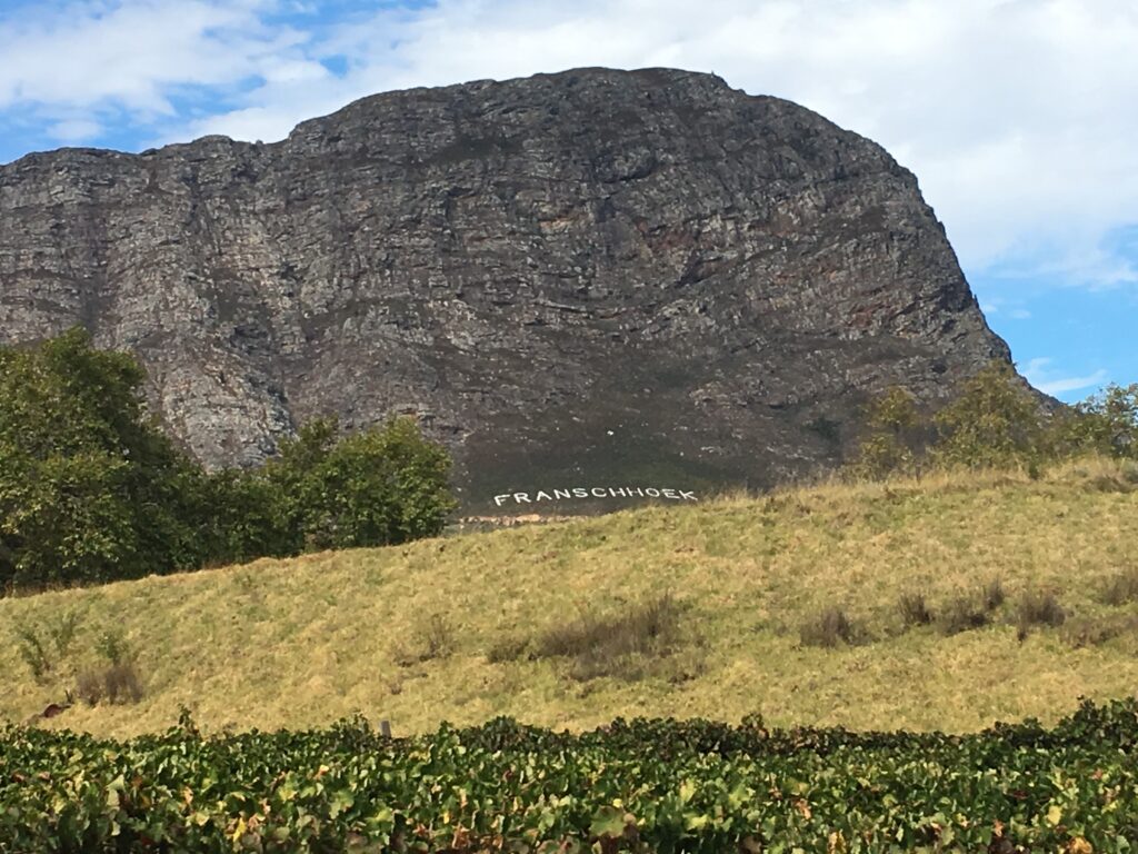
If you are looking for beautiful blue-flag beaches, ancient forests and nature reserves, the Western Cape Province has it all. The Western Cape has many craft markets, historical buildings and art festivals.
If you want animal experiences, the Western Cape Province is the perfect spot. You can watch whales in Hermanus, see the dolphins frolicking in the ocean, ride ostriches in Oudtshoorn, swim with penguins on Boulder’s Beach or visit Nelson Mandela’s prison cell on Robben Island. If you are more adventurous, you can choose from various shark-cage diving experiences or abseiling down Table Mountain.
The Northern Cape Province

| Capital city | Kimberley |
| Languages | Afrikaans (68%), Setswana (33,1%) |
| Population | 1 185 600 |
| Percentage of SA population | 2.2% |
| Area size | 372 889 square kilometres |
| Area size as a percentage of the total area of South Africa | 30.5% |
Dry and rough landscapes characterise this province. Some call the Northern Cape Province of South Africa the jewel of South Africa. Although this province may at first glance not look like it is worthy of a visit, you may be surprised to discover that large deposits of gemstones (such as opal, jasper and agate) have been found in this province. The most famous gem of the Northern Cape Province is diamonds, for which Kimberley is well-known.

Vast open plains and red dunes characterise the province. There is an explosion of coloured flowers in the Namaqualand region in spring. Many of South Africa’s national parks exist in this province, and you can find the Big 5 here. The Orange River is in the Northern Cape Province. When there have been good rains, the Augrabies Waterfall, the sixth-largest waterfall in the world, flows strongly.
If you love 4 x 4 drives, wildlife, river rafting or hiking, a visit to the Northern Cape Province will be worth your while.
Provinces of South Africa: The Eastern Cape province

| Capital city | Bisho |
| Other major cities | Port Elizabeth, also called Nelson Mandela Bay |
| Languages | isiXhosa (78,8%), Afrikaans (10,6%), English (5,6%) |
| Population | 6 916 200 |
| Percentage of SA population | 12.6% |
| Area size | 68 966 |
| Area size as a percentage of the total area of South Africa | 13.8% |
The Eastern Cape Province of South Africa features 800 kilometres of beaches alongside the Indian Ocean. The province starts at the Tsitsikamma National Park near Storms River Village, bordering the Western Cape Province, and goes past the golden sunshine coasts of Jeffrey’s Bay, St. Francis Bay and Algoa Bay, all along the wild coast to Port Edward. The beaches are, at times, interrupted by coves and lagoons. The Eastern Cape Province is popular with surfers, anglers and other vacationers.

The province has many national parks to view wildlife, including the Big 5 in a natural environment. Visitors choose the Eastern Cape province to view the Big 5 because the area is malaria-free, which is not the case with the famous Kruger National Park.
If you are a history buff, you will find many historical places to visit in the Eastern Cape Province. Former South African president Nelson Mandela was born in Qunu in this province. You can also see the rock painting by the ancient Khoi Khoi people, and discover the 19th-century town of Graaff-Reinet with the Valley of Desolation and the Anglo-Boer war battlegrounds.
The KwaZulu-Natal Province

| Capital city | Pietermaritzburg |
| Other major cities | Durban |
| Languages | isiZulu (77,8%), English (13,2%), Afrikaans (1,5%) |
| Population | 10 919 100 |
| Percentage of SA population | 19.9% |
| Area size | 94 361 square kilometre |
| Area size as a percentage of the total area of South Africa | 7.7% |
The KwaZulu-Natal province is a melting pot of Indian, Zulu and European cultures. The east coast of this province starts at Port Edward, where the Eastern Cape Province ends, and it continues up to the national border with Mozambique. This province is sometimes called the garden province because of its subtropical climate and lush green vegetation.
Learn about Durban’s weather and what to wear when you visit this city.
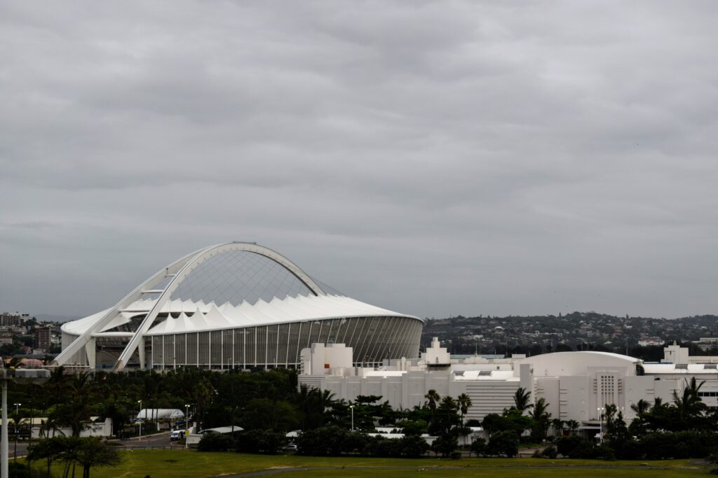
Another popular destination in KwaZulu-Natal is the uKhahlamba Drakensberg Park, which is a South Africa’s World Heritage Site and one of South Africa’s largest mountain ranges. In the Zulu land area, you will find some battle sites where the Boers/English and Zulus fought each other.
The province has beautiful beaches and is perfect for swimming in the warm waters of the Indian Ocean. Other activities in this province are snorkelling, swimming, angling, scuba diving, or just lying in the sun to relax.
Provinces of South Africa: The Free State Province
| Capital city | Bloemfontein |
| Languages | Sesotho (64,2%), Afrikaans (12,7%), isiXhosa (7,5%) |
| Population | 2 817 900 |
| Percentage of SA population | 5.1% |
| Area size | 129 825 square kilometres |
| Area size as a percentage of the total area of South Africa | 10.6% |
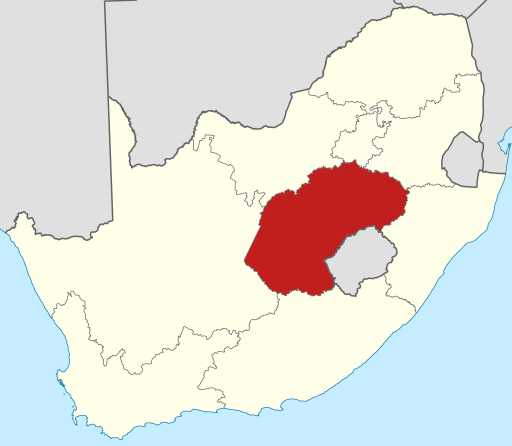
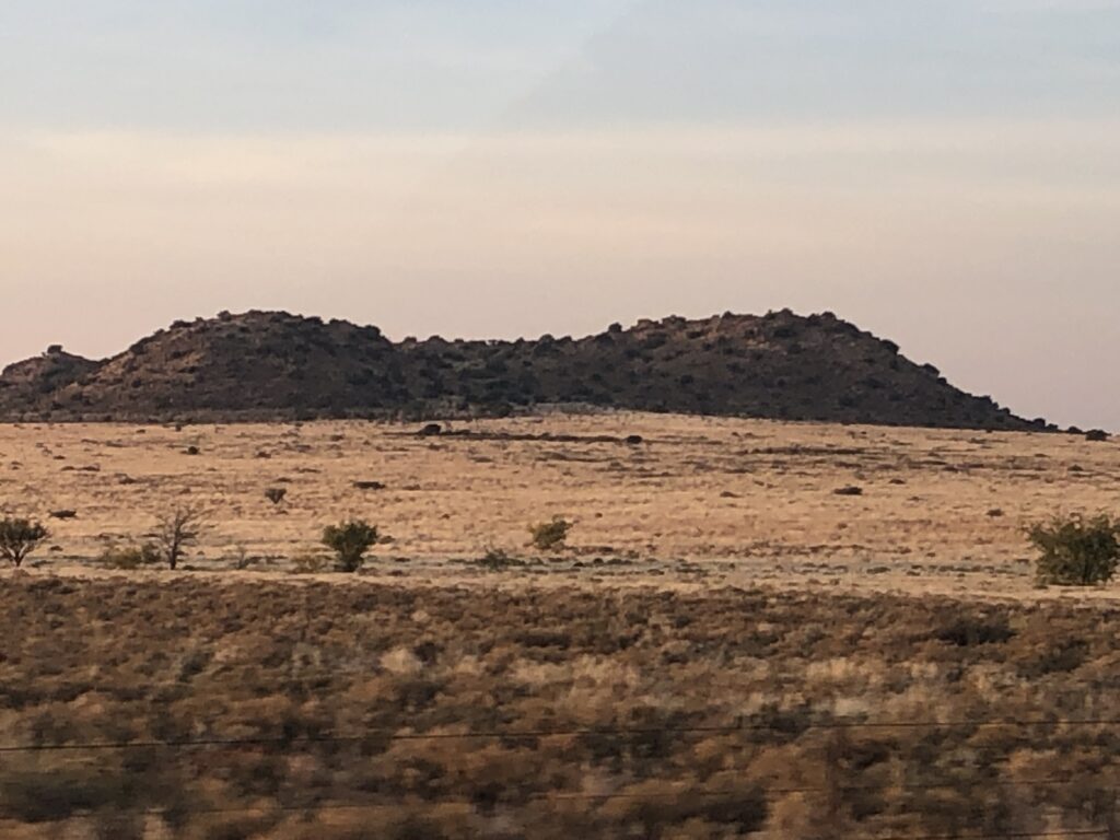
The Free State province features grassy savannas and fields of maize, wheat and sunflowers. The province has many farms, and you will see windmills throughout the region.
This province is situated in the middle of South Africa. The Free State province’s northern border is the Vaal River, and the Orange River is at its southern border.
The capital city of the Free State Province is Bloemfontein, which is the judicial capital of South Africa. Bloemfontein houses South Africa’s Supreme Court of Appeal.
A popular place in the Free State province is the Golden Gate National Park, where you can find beautiful sandstone formations. Clarens, the nearest town to the Golden Gate National Park, is a popular destination for South Africans and offers an annual craft beer festival and many art shops. You can also experience the annual cherry festival in Ficksburg in the Free State province.
Another popular destination for locals is Parys, near the northern border of the Free State province. From here, you can visit the Vredefort Dome where a meteorite fell and take part in many outdoor activities, ranging from horse riding, mountain biking and river rafting.
The North-West Province

| Capital city | Mafikeng |
| Major city | Potchefstroom |
| Languages | Setswana (63,4%), Afrikaans (9,0%), isiXhosa (5,5%) |
| Population | 3 707 000 |
| Percentage of SA population | 6.7% |
| Area size | 104 882 square kilometres |
| Area size as a percentage of the total area of South Africa | 8.7% |
The North-West province is known as the platinum province, as it produces more platinum than any other area globally. This province has two of South Africa’s national parks, the Madikwe Game Reserve and the Pilanesberg national park, near Sun City International. Here you can view wildlife and beautiful African savannah scenery. The climate in the North-West province is hot and dry, with sunshine year-round.
The Sun City Resort is a resort complex in the North-West province, which is popular as it offers many family activities. You can do a safari to view the Big 5 in nature reserves around Sun City. A nice day trip from Johannesburg is the Hartbeespoort Aerial Cableway.
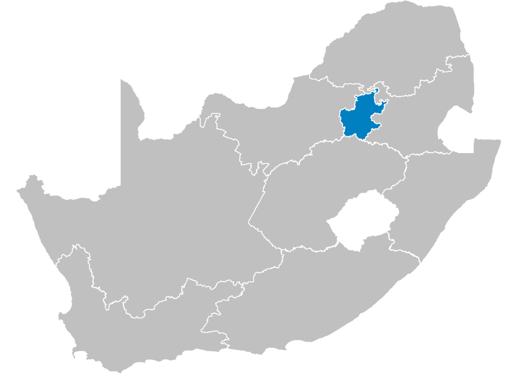
The Gauteng Province
| Capital city | Pretoria |
| Major city | Johannesburg |
| Languages | isiZulu (19,8%), Afrikaans (12,4%), English (13,3%) |
| Population | 13 200 300 |
| Percentage of SA population | 24% |
| Area size | 18 178 square kilometres |
| Area size as a percentage of the total area of South Africa | 1.4% |
Gauteng is the Sesotho word for “place of gold. In 1886 gold was discovered in Johannesburg, and this started the Witwatersrand gold rush. The history of Gauteng links to the history of gold in South Africa. Some of the small towns established in the gold rush developed into the largest cities in South Africa, and Johannesburg is an example of this.

Although Johannesburg is the largest city in Gauteng, and South Africa, the administrative capital of South Africa is Pretoria, located north of Johannesburg.
Gauteng is the economic engine of South Africa, and here you can find some of the best shopping malls in Africa. This province is the smallest of the South African provinces, but you can still find some of the best holiday destinations nearby, such as the Hartbeespoort or Magaliesburg areas.
You can also visit another of South Africa’s World Heritage site’s in this province, the Sterkfontein cave complex, also called the Cradle of Mankind. Here, the remains of several hominid fossils, over 2 million years old, were found.
Gauteng also has Cullinan, an old mining town., where the world’s largest diamond, the Cullinan diamond, was found.
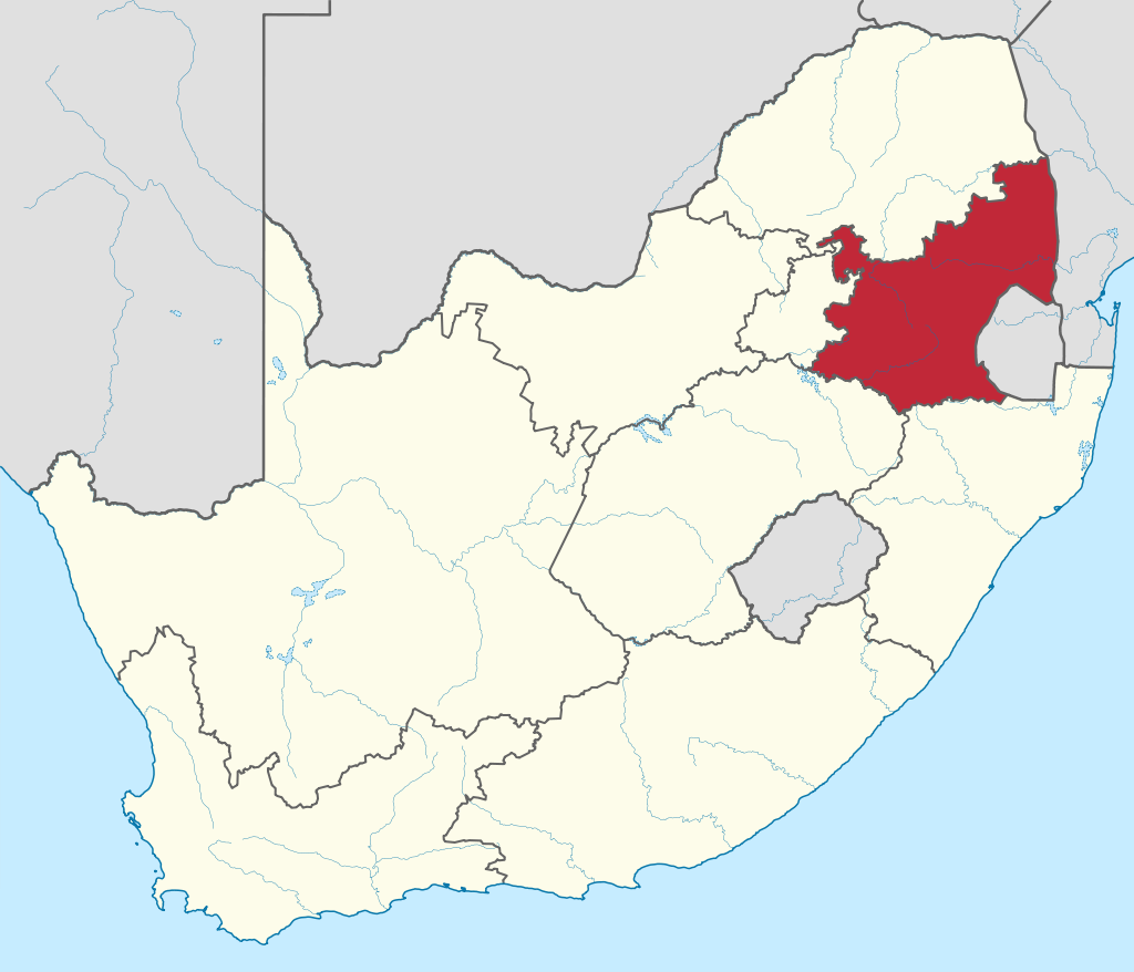
The Mpumalanga Province
| Capital city | Mbombela (previously called Nelspruit) |
| Languages | siSwati (27.7%), isiZulu (24,1%), isiNdebele (10%) |
| Population | 4 283 900 |
| Percentage of SA population | 7.8% |
| Area size | 76 495 square kilometres |
| Area size as a percentage of the total area of South Africa | 6.3% |
The Mpumalanga Province features the Northern Drakensberg escarpment in the Lowveld. The name of the is SiSwati for the place of the rising sun. You can find stunning natural beauty and diverse cultures here. It offers a range of sights to see, ranging from wildlife, mountain retreats, ancient ruined cities and villages, and wild water sports.
The famous Kruger National Park is in the Mpumalanga province. Although it is not a malaria-free area, it remains extremely popular with both local and international visitors.

You can find forest plantations consisting of pine, gum or wattle trees in Mpumulanga. The province has many historical sights from the gold rush. Furthermore, you can also visit the Sudwala caves, where people made several archaeological discoveries, here.
Other popular destinations with local and foreign visitors include the Panorama Route passing by Graskop with the big swing, many waterfalls and God’s Window, Africa’s largest canyon. Read more about the attractions of the Mpumalanga Province.
The Limpopo Province

| Capital city | Polokwane (previously called Pietersburg) |
| Languages | Sepedi (52,9%), Xitsonga (16.9%), Tshivenda (16,7%) |
| Population | 5.3 million |
| Percentage of SA population | 10.4% |
| Area size | 5 726 800 square kilometres |
| Area size as a percentage of the total area of South Africa | 10.3% |
The Limpopo province is in the north of South Africa. The province’s name is from the Limpopo River, which forms its northern and western boundaries. The region is known for its beautiful African bushveld and wildlife.
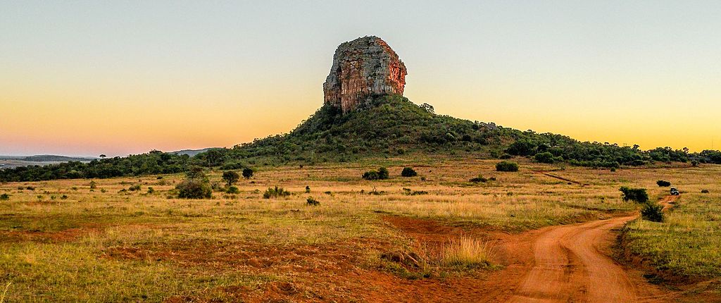
There are many game farms and provincial and private game farms in the Limpopo province, including the Kruger National Park at its eastern border. Here are some more attractions in Limpopo.

You can also find many resorts with hot springs in Limpopo. These hot mineral baths are perfect for getting out of the African heat and relaxing your muscles.
Regarding culture and history, Limpopo has the heritage sites of the Makapans valley, which is more than three million years old. You can also visit the Rain Queen Modjadji in the rainforest near Tzaneen.
